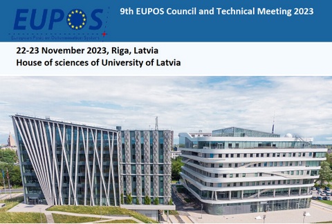
International Symposium on Global Navigation Satellite Systems, Space-based and Ground-based Augmentation Systems and Applications Berlin, Germany, 30 November - 2 December 2009Organised and co-organised by the Land Berlin, represented by the Senate Department for Urban Development, the International EUPOS® Steering Committee, the International Committee on Global Navigation Satellite Systems and the United Nations Office for Outer Space Affairs Programme CommitteeGerd Rosenthal, Berlin Senate Department for Urban Development and International EUPOS Steering Committee Office (EUPOS ISCO) Sharafat Gadimova, United Nations Office for Outer Space Affairs (UN OOSA) and ICG Secretariat Prof. Hans Haubold, United Nations Office for Outer Space Affairs (UN OOSA) and ICG Secretariat Dr Johannes Ihde, Federal Agency for Cartography and Geodesy (BKG) and International Association of Geodesy Reference Frame Sub-Commission for Europe (EUREF) Programme
Monday, 30 November 2009 Registration Come together Tuesday, 1 December 2009Visit of the Berlin SAPOS / EUPOSreference station centre and the GNSS robot for absolute GNSS antenna calibration Opening session Greetings Permanent secretary Ms Hella Dunger-Löper (Berlin), Hans J. Haubold (UN OOSA / ICG), Gerd Rosenthal (EUPOS ISCO, Berlin)
Session 1 Chairperson: Raymond Clore ICG and its Programme on GNSS Applications Hans J. Haubold (United Nations Office for Outer Space Affairs, Austria) [pdf]
Results of the Fourth Meeting of the International Committee on Global Navigation Satellite Systems (ICG-4), St. Petersburg, Russian Federation, 14 – 18 September 2009 Hans J. Haubold, Sharafat Gadimova (Secretariat of the International Committee on GNSS, Austria), Johannes Ihde (EUREF) [pdf]
EUPOS - a ground based regional GNSS augmentation network: current status and perspectives István Fejes (Institute of Geodesy, Cartography and Remote Sensing, FÖMI Satellite Geodetic Observatory, Hungary) [pdf]
Session 2 Chairperson: Hans J. Haubold Galileo / EGNOS Werner Enderle (GNSS Supervision Agency, Belgium) [pdf] GPS and Worldwide GNSS Interoperability Raymond Clore (U.S. Department of State, United States of America) [pdf] The International GNSS Service in a challenging field of developing GNSS Satellite Navigation Systems Urs Hugentobler (IGS / Technical University Munich, Germany) [pdf] Evolution of the EPN resources towards real-time GNSS Johannes Ihde (EUREF, Federal Agency for Cartography and Geodesy, Germany), Carin Bruyninx (EUREF TWG), Wolfgang Söhne, Georg Weber (Federal Agency for Cartography and Geodesy, Germany) [pdf]
Session 3 Chairperson: Werner Enderle Single site design, reference frames Jaroslav Šimek (Geodetic Observatory Pency, Institute of Geodesy, Topography and Cartography, Czech Republic) [pdf] EUPOS working group SQII: GNSS reference station service, international interoperability and quality Janis Zvirzgds (Latvian Geospatial Information Agency, Latvia) [pdf] Realisation and funding of DGNSS networks Arunas Buga (Vilnius Gediminas Technical University, Lithuania), [pdf] Nicola Schmeling (advisor for EU funding, Germany) [pdf]
Wednesday, 2 December 2009
Session 4
Chairperson: Urs Hugentobler EUPOS network solution Madara Caunite,Inese Janpaule, Jānis Balodis,(University of Lavia, Latvia) [pdf]
EUPOS-Riga network elevation analyses Jānis Balodis, Gunnar Silabriedis, Ingus Mitrofanovs (Institute of Geodesy and Geoinformation, University of Latvia), Janis Zvirzgds (Riga Technical University, Latvia) [pdf] Development and application of DGNSS in Bulgaria Keranka Vassileva, Georgi Milev (Bulgarian Academy of Sciences, Institute of Water Problems), Ivo Milev (EUPOS RTCM representative, Germany) [pdf]
Session 5 Chairperson: Keranka Vassileva
Development of CORS Network in Georgia George Gotsiridze (National Agency of Public Registry, Ministry of Justice of Georgia) [pdf] Some areas of use of applied space technologies in Uzbekistan Igor Ibragimov, D. Sh. Fazilova (Astronomical Institute, Uzbekistan Academy of Science) [pdf]
ROMPOS for cadastre applications Tiberiu Rus, Petre Dragomir, Neculai Avramiuc, Paul Dumitru, Mihaela Fădur, Vlad Sorta (National Agency for Cadastre and Land Registration, Romania) [pdf] Landslide analysis using GPR, GNSS and terrestrial laser scanning technologies Aleksandar Ristić, Miro Govedarica, Dušan Petrovački (University of Novi Sad, Serbia) [pdf]
Session 6
Chairperson: Arunas Buga Decentralised city traffic management system with use of radio navigating satellite system GPS/GLONASS, and traffic control system based on geoinformation technologies Alexander Tuzikov, V. A. Lapitsky, G. A. Khristich, A. N. Kriuchkov, E. E. Sotikova, A. A. Kravtsov (United Institute of Informatics Problems, Belarus) [pdf] Flooding bank's structure modelling using GPR, GNSS and airborne laser scanning technologies Aleksandar Ristić, Dušan Petrovački, Miro Govedarica (University of Novi Sad, Serbia) [pdf] SKPOS contributions to geokinematic research Branislav Droščák (Geodetic and Cartographic Institute Bratislava, Slovakia) [pdf] GNSS and high resolution satellite data for warning vulnerability risk Sevda R. Ibrahimova (Institute for Space Research of Natural Resources, National Aerospace Agency, Azerbaijan) [pdf]
Closing session
Conclusions Hans J. Haubold (UN OOSA / ICG), Gerd Rosenthal (EUPOS ISCO / Berlin)
|